Machine Learning in GIS : Land Use Land Cover Image Analysis

- Description
- Curriculum
- FAQ
- Reviews
Advanced Land Use/Land Cover Mapping with Machine Learning
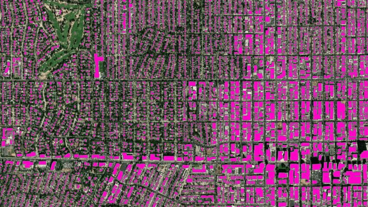
Are you looking to advance your geospatial analysis skills using QGIS? Want to master object-based image analysis and harness the power of Machine Learning algorithms for Land Use and Land Cover (LULC) mapping? This course is designed to take QGIS users from basic geospatial analysis to performing advanced tasks with confidence. Explore object-based image analysis with various data sources and cutting-edge Machine Learning algorithms. Dive into LULC mapping, change detection, and object-based crop type mapping using QGIS and Google Earth Engine.
Course Highlights:
-
Advanced geospatial analysis using QGIS
-
Object-based image analysis
-
Machine Learning algorithms for LULC mapping
-
Practical exercises with QGIS and Google Earth Engine
-
Installation and configuration of open-source GIS software
-
Supervised and unsupervised Machine Learning
-
Accuracy assessment for geospatial projects
Course Focus:
This advanced course is designed to equip you with practical knowledge in advanced Land Use and Land Cover (LULC) mapping and object-based image analysis. Gain confidence in using Machine Learning algorithms for geospatial tasks and leverage the capabilities of QGIS and Google Earth Engine. Whether you’re a geographer, programmer, social scientist, or geologist, this course will enhance your GIS and Remote Sensing skills.
What You’ll Learn:
-
Installing and configuring open-source GIS software (QGIS and Orfeo Toolbox)
-
Navigating the QGIS software interface, including its main components and plug-ins
-
Classifying satellite images with different Machine Learning algorithms in QGIS
-
Collecting training and validation data and performing accuracy assessments
-
Object-based image analysis and object-based crop type mapping in QGIS
-
Running supervised and unsupervised Machine Learning Algorithms in Google Earth Engine
Who Should Enroll:
This course is ideal for professionals seeking to advance their geospatial analysis skills, including geographers, programmers, social scientists, geologists, and anyone needing to use LULC maps in their field. Whether you’re planning to create land cover and land use maps, tackle geospatial challenges, or explore the cutting-edge LULC techniques, this course provides the skills and confidence you need.
INCLUDED IN THE COURSE: Gain access to all course materials, including data, Java code files, and future resources. Enroll today to take your geospatial analysis to the next level!
-
8
 Section Overview
 -
9
 Introduction to Machine Learning
 -
10
Basics of machine learning for classification analysis
-
11
Unsupervised (K-means) image analysis in QGIS
-
12
Common algorithms of image classification
-
13
Land cover classification on the cloud using EO browser
-
14
Random Forest classification in OTB
-
15
SVM classification in OTB
-
16
DT classification in OTB
-
17
Accuracy Assessment